Google Singapore just released 30 completely new Street View locations in Singapore that lets you explore breathtaking views of our national parks, surrounding islands and popular attractions in 360˚ panoramic awesomeness. It makes you wonder if you have truly discovered Singapore. Scroll down for the full list!
You may use Street View on a desktop or open Google Maps on your Android or iOS smartphone.
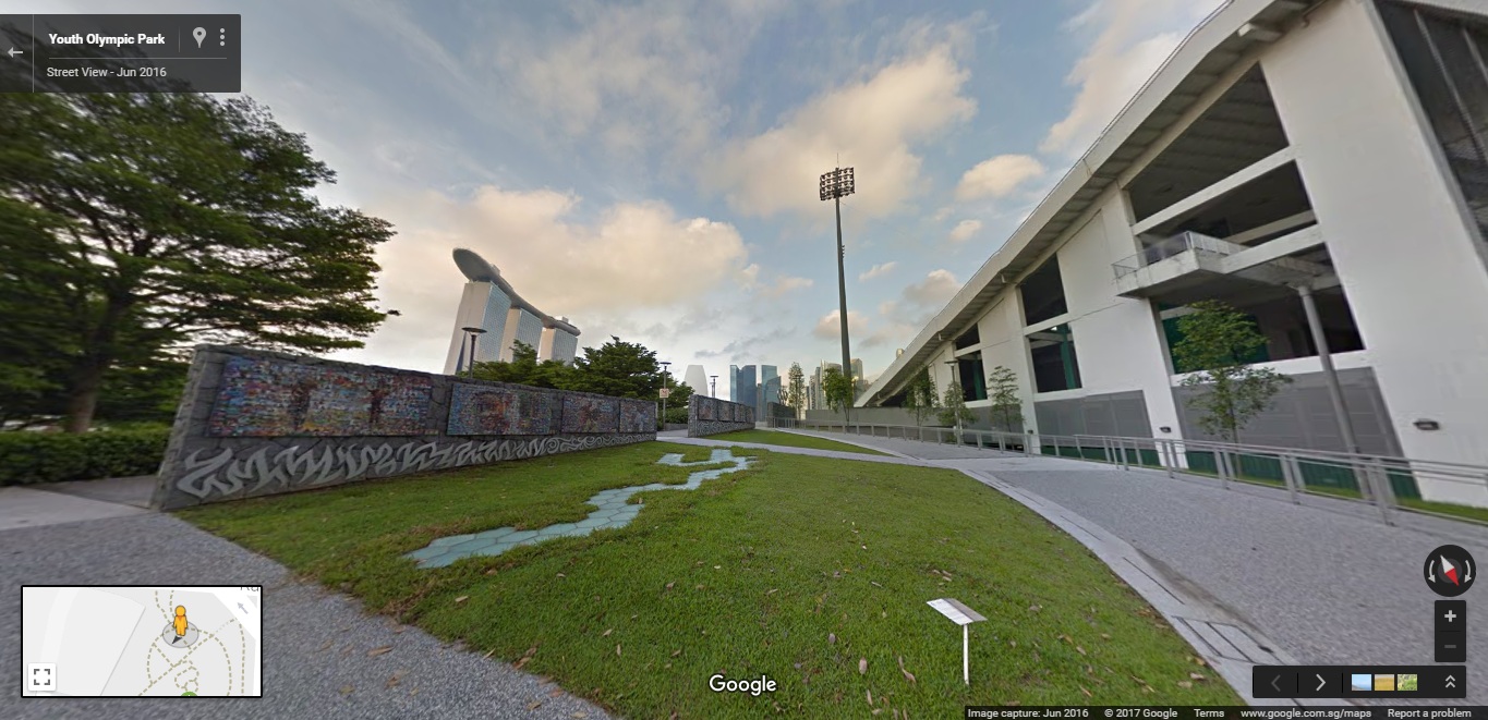
If you are an avid cyclist, plan your bike expedition routes along Coney Island Park, Punggol Waterway Park or even the Youth Olymic Park anytime of the day! Or even if you are looking to plan you next staycation in Resorts World Sentosa, familiarising with your destination has never been that simple. Arts and heritage buffs will also be able to step into National Gallery Singapore and the Singapore Art Museum, at your own convenience.
Singapore is a top Asian destination for tourists worldwide and having the newly added Special Collections on Street View will give tourists a first glance of what our city has to offer. Many people have told us that Street View helps them in their trip planning when they’re deciding places to visit while on holiday.
– Cynthia Wei, Street View Program Manager, APAC
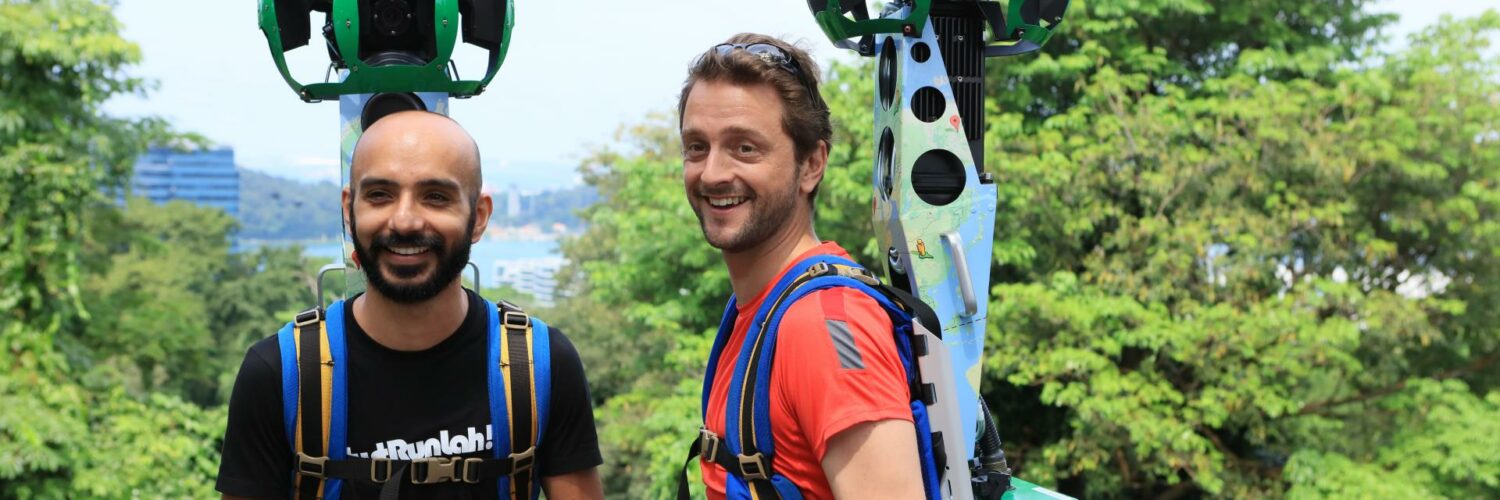
JustRunLah!
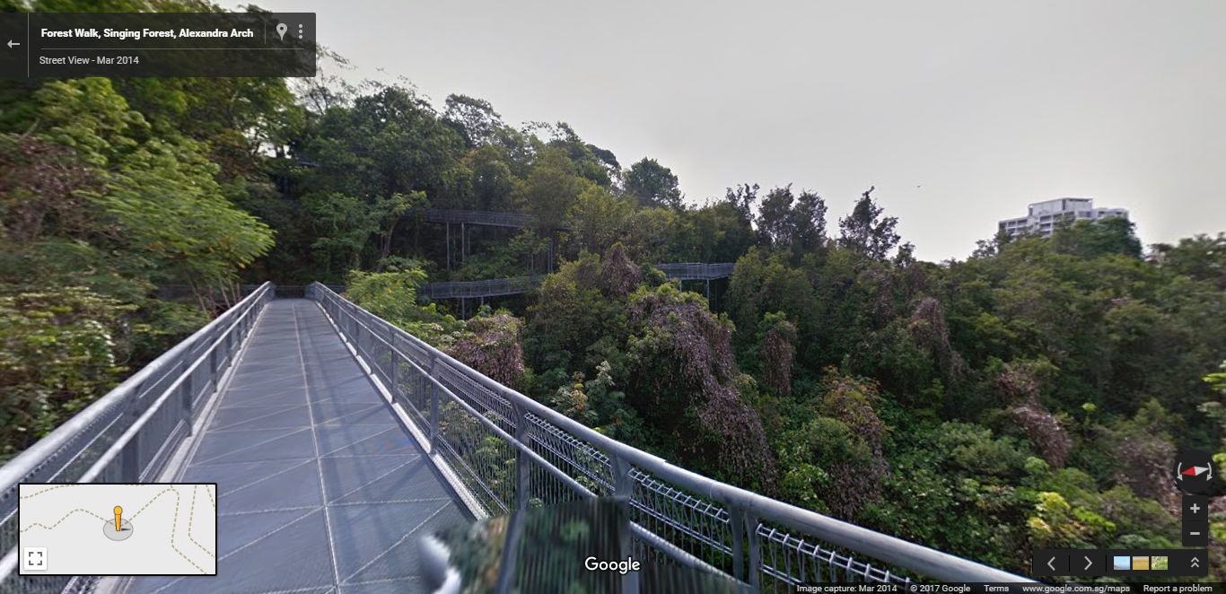
Starting today, JustRunLah! (a group of running enthusiasts) will be teaming up with Google to capture Street View imagery along parks and nature spaces around the nation that features running tracks. The local group is coming on board to contribute and expand on the Street View imagery around Singapore. With over 30 running routes covering more than 400 km, be sure to say hi when you see them donning Google’s Street View trekker. It is equipped with special cameras that take photographs of the various running trails popular among Singaporeans such as Botanic Gardens, Mount Faber Park and MacRitchie Reservoir.
Since 2009, Singaporeans have been using the panoramic street-level images on Google Maps to navigate and figure out driving directions around the city. While Street View has proven to be a useful tool for drivers, we’d love to make it more relevant for Singaporeans who are passionate about running and looking for new places to explore. We’re looking forward to working closely with JustRunLah! to capture new imagery of running tracks that are off the beaten path and help get Singaporeans more active with Street View.
– Cynthia Wei, Street View Program Manager, APAC
Full List
National Parks and Islands |
| Ang Mo Kio Town Garden East Mo Kio Town Garden West Chinese Garden Coney Island Park Duxton Plain Park Japanese Garden Kusu Island Punggol Promenade Punggol Point Walk Punggol Waterway Park Seringat Island Lazarus Island St John’s Island Sungei Buloh Wetland Reserve Telok Ayer Green Park Toa Payoh Sensory Park Toa Payoh Town Park Youth Olympic Park |
Heritage Sites and Tourist Attractions |
| Adventure Cove Waterpark Buddha Tooth Relic Temple Resorts World Sentosa, Beach Villas Resorts World Sentosa, ESPA Resorts World Sentosa, Hard Rock Hotel Resorts World Sentosa, Ocean Restaurant by Cat Cora World Sentosa, SEA Aquarium Resorts World Sentosa, The Forum Resorts World Sentosa, The Galleria Singapore Turf Club Universal Studios Singapore |
Shopping Malls |
| Food Town at Wisma Atria TANGS at Tang Plaza |
🤓 Like what you read?
Stay updated by following us on Telegram, Facebook, Instagram or on our YouTube channel.